Observations and Data

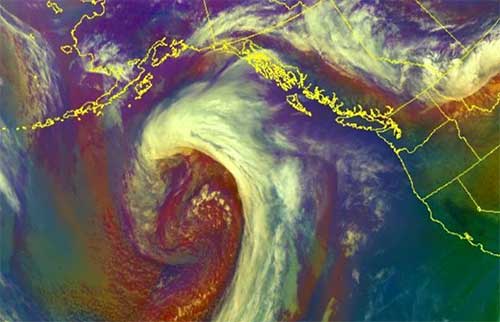
GOES-West - Northern Pacific Air Mass - California Coastal Records Project - Aerial photographic survey of the California Coastline.
- CoastWatch - NOAA's CoastWatch Program: publicly available near real-time oceanographic satellite data.
- Russian River Flow Data - USGS National Water Information System
Buoy Based Observations
- NOAA/NDBC National Data Buoy Center
- NOAA/NDBC Buoy Station 46013 - Bodega Bay, 48NM North Northwest of San Francisco, CA
- The Coastal Data Information Homepage (CDIP)
- NOAA El-Nino Watch
Tracking Observations
- Automatic Information System (AIS) Ship Traffic Map- Near real time
- Tagging of Pacific Pelagics (TOPP)- Near real time
Climatology
- Cal-Adapt - Exploring California's climate change research.
- California Climate Tracker - Tracking climate variability and change for the state.
- NOAA Climate Change Program - Understanding climate variability and change.
- National Climatic Data Center - NCDC: world's largest active archive of weather data.
Water Quality
- USGS National Water Information System - Real time
- Sonoma County Ocean Water Quality Monitoring - Bacterial water quality monitoring results.
- Beach Report Card @ HealTheBay.org - Monthly
Forecasts
- National Weather Service - San Francisco Weather Homepage
- NOAA Northern California Graphical Weather Forecasts
- Windy - Worldwide animated weather map
Tides
