
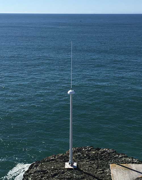
Instrument Type: CODAR Ocean Sensors SeaSonde High Frequency Radar System
High Frequency Radar is used to measure the currents at the ocean surface, called sea surface currents. Similar to ADCPs a radar transmitter sends a signal out to sea and the conductive seawater surface returns a signal that measures the Doppler shift to determine the velocity and direction. High frequency radar instruments are deployed on shore and are generally operated in a pair or a network.
 Sea surface current data is measured with SeaSondes, compact HF radars designed by CODAR Ocean Sensors, Ltd. They use patented FMCW (frequency modulated continuous wave) signal processing and crossloop direction finding to measure ocean surface currents and wave parameters of the coastal ocean. Each station consists of a transmitter, receiver, 2 antennas, and data acquisition and processing computers. A transmitter broadcasts a frequency modulated radio frequency pulse at 2Hz (two pulses per second). The Doppler shifted return signal (sea echo) is detected with a compound cross loop/monopole receive antenna and the signal is processed into estimates of surface current speed and direction and wave heights, period and direction. BML's three 12 MHz stations have a spatial resolution of 2 km and create hourly maps of surface currents out to a distance of 30-50 km (20-30 miles) along a 65 km (40 mile) length of shore. Onshore wave directional spectral data are also produced. Total coverage area for the 3- radar array is approximately 2800 km2. BML's two 5 MHz stations have a spatial resolution of 5 km and create hourly maps of surface currents out to a distance of 90-200 km (55-125 miles). Onshore wave directional spectral data are also produced.
Description: High-frequency (HF) radar uses radio-wave backscatter to map surface currents over wide swaths of the coastal ocean. These sensors are commonly referred to by the trade name "CODAR" (Coastal Ocean Dynamics Applications Radar) and take advantage of the propagation of radio waves over large distances out and back across the surface of the conducting sea water, and they have resonant interactions with ocean surface waves (i.e., the ones that can make people seasick). Back at the shoreline, a measurement of the frequency offset (i.e., Doppler shift) of the reflected radio waves provides a remotely sensed measurement of the speed of the ocean waves and surface currents.
Also see
Using Radar to Understand Our Ocean
Locations:
- 5 MHz - Trinidad: 41°04.414'N,124°09.467'W - Installed: 2008
- 5 MHz - Samoa: 40°46.127'N,124°13.126'W - Installed: 2022
- 5 MHz - Shelter Cove: 40°02.002'N,124°04.732'W - Installed: 2008
- 5 MHz - Fort Bragg: 39°26.281'N,123°48.967'W - Installed: 2010
- 5 MHz - Point Arena: 38°55.706'N,123°43.666'W - Installed: 2007
- 5 MHz - Bodega Marine Laboratory: 38°19.169'N,123°04.417'W - Installed: 2007
- 13 MHz - Salt Point State Park: 38°34'0.5"N,123°19'53.7"W - Installed: 2002
- 13 MHz - Bodega Marine Laboratory: 38°19.039'N,123°04.348'W - Installed: 2001
- 13 MHz - Point Reyes: 38°2'49.7"N,122°59'20.9"W - Installed: 2001
- 13 MHz - Slide Ranch: 37°52.350'N,122°35.855'W - Installed: 2008
- 25 MHz - Point Bonita: 37°48.929'N,122°31.794'W - Installed: 2010
Specifications
Surface currents:
Map spatial resolution: 2 x 2 km for 13MHz, 6 x 6 km for 5Mhz
Map temporal interval: hourly; currents averaged over one hour
Map area coverage: 65-200 km along shore x 30 km offshore, variable
Map vector accuracies: speed < 7 cm/s, direction < 10°
Waves:
Target range: 3 km from coast around each radar
Significant wave height accuracy: 7 to 15%
Dominant on-shore direction accuracy: 5° to 12°
Dominant wave period accuracy: 0.6 s
Minimum detectable significant wave height: 1 m
Wave temporal interval: hourly; waves averaged over one hour
Specifications - Radiated signal:
Output radiated power: 80 watts peak, 40-60 watts average
Operating frequency range: 4-25 MHz