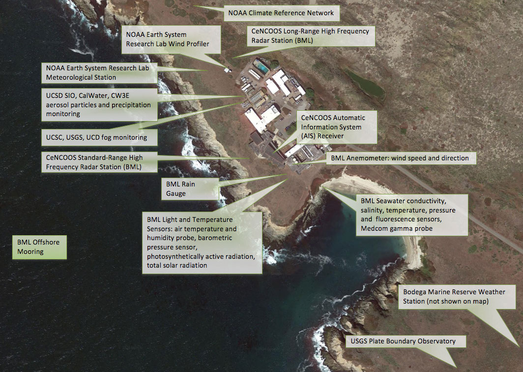
The Bodega Ocean Observing Node, located on the Bodega Marine Reserve, shares the neighborhood with several other on-site instrument platforms operated by partner institutions, listed below.
Please note that the Bodega Marine Laboratory Bodega Ocean Observing Node is not responsible for the measurements listed below, these links are provided as references. For questions about these data, contact the appropriate operating organizations.

NOAA ESRL (Earth System Research Laboratory)
- Wind Profiler Data and Plots (scroll to "Bodega Bay")
- Meteorological Data Downloads
- Surface Meteorology Times Series Plots (file download)
NOAA Climate Reference Network
UC Natural Reserve System Sensor Network
USGS Pacific Coastal Fog Project
UNAVCO Plate Boundary Observatory
- UNAVCO - Plate Boundary Observatory
- Overview of Bodega Head Station
- Station Info and Data Downloads including Meteorological Observations (Station P183)
- To view observations graphically on the station page: In the Station Data box, under "Meteorologic Plots", click on "Available"
- OR Download raw data (text format) at the original sampling rate (1 minute) using the Unavco data archive web interface
- PBO 1 Hz real-time data streams (GPS + Met)
CeNCOOS and Naval Postgraduate School Ocean Acoustics Laboratory Shiptrack Monitoring
Safecast Measurements
Safecast Radiation Measurements - Safecast is a volunteer driven non-profit organization whose goal is to create useful, accessible, and granular environmental data for public information and research. Begun in response to the nuclear disaster in Japan in March, 2011, Safecast collects radiation and other environmental data from all over the world.

