



Pigeon Point Wave Buoy
Location: 38.1896833° N,-122.9285333° W

Deployed: January 2025
The Tomales Bay Pigeon Point mooring is located just south of Hog Island in Tomales Bay in approximately 30’ of water. The purpose of this buoy is to collect oceanographic data that will allow researchers to answer various ecological and oceanographic questions, as well as provide comparative data related to sea conditions within the inner and outer bay.
Non-real-time sensors include:
- Near-surface SBE 37 (temperature and salinity)
- Near-surface PME MiniDOT (dissolved oxygen)
- SBE 39 thermistor string
- Near-bottom SBE 37 (temperature and salinity)
- Near-bottom PME MiniDOT (dissolved oxygen)
Real-time observations include:
- Sea surface temperature
- Wind speed and direction
- Wave height
Pigeon Point Real-Time Wave Data
Inverness Wave Buoy
Location: 38.1180333° N,-122.8669167° W
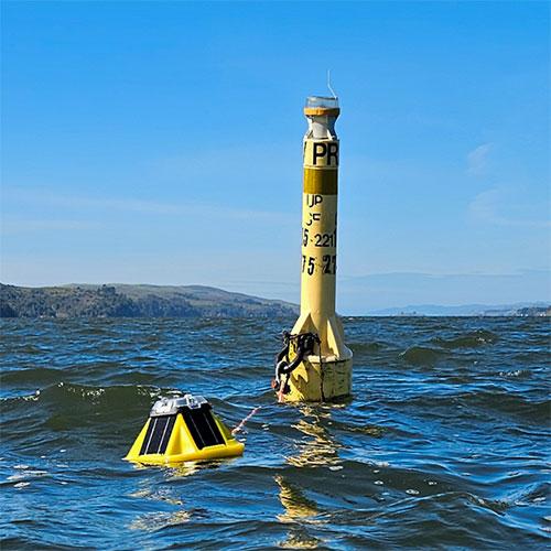
Deployed: February 2024
The Inverness mooring is located northeast of Inverness, CA in Tomales Bay in approximately 15’ of water. The purpose of this buoy is to collect oceanographic data that will allow researchers to answer various ecological and oceanographic questions, as well as provide data related to sea conditions within the inner bay.
Non-real-time sensors include:
- Near-surface SBE 37 (temperature and salinity)
- Near-surface PME MiniDOT (dissolved oxygen)
- Near-bottom SBE 39 thermistor
Real-time observations include:
- Wave height
- Wave direction
- Sea surface temperature